


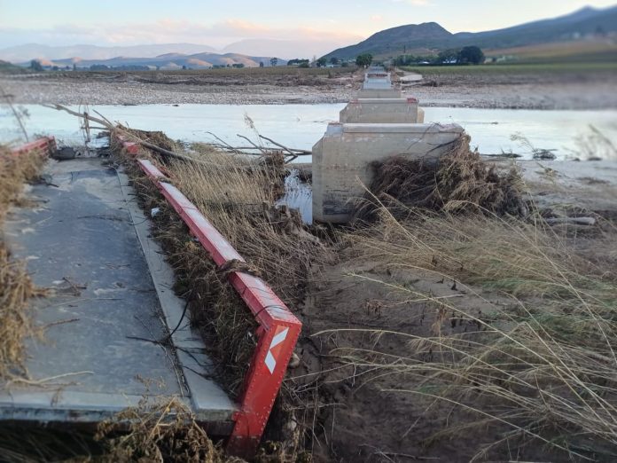
Provincial Disaster Management authorities are on high alert as the South African Weather Service has warned of a Level 8 storm in some parts of the province this Wednesday into Thursday, upgraded from Level 5.
Local Government MEC Anton Bredell says Disaster Management officials were briefed by the weather service today on the severe cut-off low-pressure system expected to affect the Central Karoo and eastern parts of the Garden Route.
“We are urging residents, businesses, farmers and municipalities to prepare for severe weather conditions expected across the province from Wednesday, 3 June, to Thursday, 4 June,” Bredell said.
According to SAWS, the cut-off low-pressure system is expected to bring heavy rainfall, strong winds, very cold conditions and rough seas, with the Garden Route and parts of the Central Karoo likely to be most severely affected. The municipalities of Bitou, Knysna and George can expect accumulated rainfall of up to 200 mm.
In the Karoo, the Beaufort West Municipality can anticipate between 60 mm and 80 mm of rainfall over the two days.
The expected heavy rainfall, combined with the impacts of the severe storms that affected the same regions during May, has contributed to the high Impact-Based Warnings issued by SAWS today.
A Level 8 warning has been issued for the eastern parts of the Garden Route, while a Level 4 warning has been issued for the Central Karoo, including Laingsburg and Swellendam.
“Such significant rainfall on already saturated ground increases the risk of flooding in low-lying areas, informal settlements, roads and river catchments. Given the recent rainfall across the province and already saturated catchment areas, there is an elevated risk of rising river levels, dam spillages, infrastructure damage and disruptions to essential services. Rural and farming communities may become isolated if roads are flooded or damaged.
“Along the coast, rough sea conditions and wave heights of up to five metres are expected, posing a risk to small vessels and coastal activities.”
Bredell says provincial and municipal disaster management structures have been activated and are monitoring developments closely.
Residents in affected areas are encouraged to take precautionary measures before the storm arrives.
Farmers and rural communities are advised to prepare for possible isolation by ensuring sufficient supplies for people and livestock, securing equipment and infrastructure, and moving livestock away from flood-prone areas where necessary.
“Please avoid crossing flooded roads, bridges and rivers, remain indoors where it is safe to do so, keep emergency contact numbers readily available, and follow instructions issued by local authorities and emergency services,” Bredell said.