
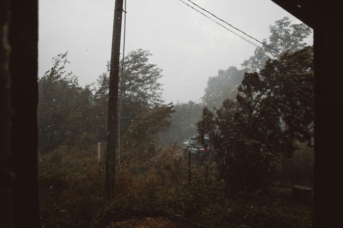
While spring is almost here, winter is not ready to move on. This is amid new weather alerts from the South African Weather Services (SAWS) for Western Cape. At the same time, the provincial authorities are on high alert as a series of severe weather conditions are expected to hit the region from Tuesday to Thursday.
🍃Weather alert update for tomorrow: 27 August 2024.
Yellow(L2) & Orange(L6) level warning: Damaging winds
Area affected: Eastern Cape, Western Cape & Northern Cape. #saws #weatheroutlook #southafricanweather pic.twitter.com/DmY1VdEEX3— SA Weather Service (@SAWeatherServic) August 26, 2024
Provincial Local Government, Environmental Affairs, and Development Planning MEC, Anton Bredell, urged the public to take note of these warnings.
The intense cold front is expected to bring heavy downpours, snowfall over mountains, very cold conditions, and strong to gale-force winds from Tuesday to Wednesday.
A Level 6 warning was issued for damaging winds over the Garden Route, eastern Overberg, eastern parts of the Cape Winelands, and the southern Central Karoo on Tuesday. SAWS predicts high waves ranging from 4 to 8 metres between Lambert’s Bay and Plettenberg Bay, accompanied by strong north-westerly to westerly winds of 60 to 80 km/h, with gusts reaching up to 100 km/h. These conditions are expected to create choppy and rough seas.
Bredell emphasised the importance of taking the warnings seriously. He says the public should especially avoid activities along the coast and at sea, cautioning recreational sailors in small boats and rock anglers. Small stock farmers have also been advised to prepare for these challenging conditions.
“We call on people to be mindful of the expected severe weather. Soils are saturated from the recent rains, so we can expect trees being uprooted, and damage to wind-exposed structures is possible.”
In addition to the Level 6 warning, a Yellow Level 2 warning for wind has been issued for the entire Western Cape, excluding the northern parts of the West Coast district. A similar warning for rain has been issued for the Cape Winelands, City of Cape Town, and parts of the West Coast, with potential localised flooding expected on Tuesday.
SAWS further advised that extremely high fire danger conditions are expected over Beaufort West, Prins Albert, Oudtshoorn, and George Municipalities on Tuesday.
Bredell further highlighted that a collaborative inter-provincial approach is required for managing such weather events.
“This weather system will also impact the Northern Cape coast and could potentially reach the Eastern Cape coast as well. It makes sense for us to work together during these severe weather events. As such, I am in full support of the MOU we have in place for cooperation between the coastal provinces, which also includes KwaZulu-Natal.”
ALSO READ: Stormy weather funerals in the spotlight
