


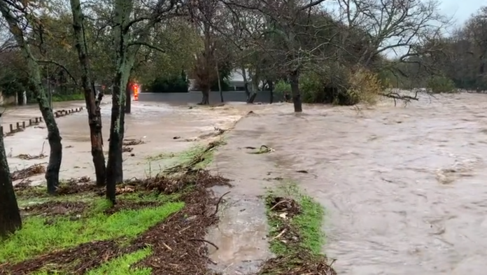
The Western Cape Provincial Disaster Management Centre has placed the province on high alert following an Orange Level 8 warning for disruptive rainfall issued by the South African Weather Service (SAWS).
According to SAWS, an intense cut-off low-pressure system is expected to affect the province from Tuesday afternoon (5 May), peaking on Wednesday (6 May), and continuing into Thursday (7 May). Most of the country will experience adverse weather.
The Garden Route District is expected to be the most severely affected, with rainfall totals of up to 150–200mm possible in parts of the region. High-intensity rainfall over short periods could lead to flash flooding, especially in low-lying and flood-prone areas.
Areas that suffered from wildfires during the summer months are particularly vulnerable now, and heavy rain could result in mudslides.
In addition to heavy rain, the system is expected to bring:
• Strong to gale force winds
• Very rough sea conditions, particularly between Cape Agulhas and Plettenberg Bay
• Dangerous waves posing a risk to coastal infrastructure and public safety
• Cold conditions, with possible snowfall over high lying areas and mountain passes
The Provincial Disaster Management Centre, together with municipalities and emergency services, has activated monitoring and preparedness measures across affected districts. Dam and river levels are being monitored continuously, particularly where dams are already close to capacity.
Residents are urged to:
• Avoid unnecessary travel during the peak of the weather event.
• Stay away from rivers, streams and flooded roads.
• Refrain from coastal and marine activities.
• Secure loose items around homes that might become dislodged during strong winds.
• Follow official warnings and updates from authorities.
Emergency services are on standby, and the province will continue to issue regular updates as conditions evolve. For emergencies, residents are advised to contact their local authorities.
Western Cape Weather Outlook (Next Few Days):
Tuesday (5 May):
• Heavy rain develops over the Central Karoo and eastern Garden Route (Level 4 warning)
• Localised flooding and service disruptions possible
• Snow expected in Karoo Hoogland and Beaufort West from evening into Wednesday
Wednesday (6 May):
• Conditions worsen significantly
• Very heavy rain in the eastern Garden Route (Level 8 – highest warning)
• Flooding risks increase across Central Karoo, Kannaland and Hessequa (Level 6)
• Strong, damaging winds inland
• Rough seas begin along the southern coastline
Thursday (7 May):
• Continued heavy rain and flooding, especially in the Garden Route
• Coastal areas from Cape Agulhas to Plettenberg Bay face damaging winds and waves (Level 6)
• Smaller harbours between Cape Point and Cape Agulhas may be disrupted
• Muddy, difficult driving conditions on dirt roads in parts of the Overberg and Cape Winelands