

While disaster management officials are still assessing the damage caused by the past weekend’s stormy weather, preparations ahead of the next cold front are already underway.
A severe cold front made landfall early on Sunday, lashing the province with strong gusts of wind, heavy downpours and snow. Thousands of people have been left displaced.
READ MORE: Thousands affected as WC hit by gale force winds, heavy rain and snow
The Department of Local Government, Environmental Affairs and Planning recorded widespread disruptions and damage, including the loss of shelter in informal settlements, localised flooding, fallen trees, electricity outages, and road closures due to snow or flooding across parts of the province.
Significant rainfall has been recorded between Sunday and Monday: Ceres received 123mm and Elgin Grabouw received 84mm. Observatory in Cape Town recorded 47mm, and Stellenbosch measured 68mm for the same period.
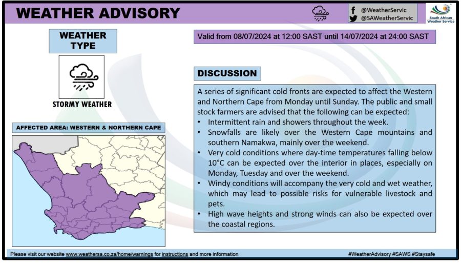
At the same time, an orange level 6 warning for disruptive rainfall is in place for Tuesday with heavier thundershowers expected over the City of Cape Town, as well as the Drakenstein and Stellenbosch municipalities. Cold, wet and windy conditions will persist until Friday.
“We are concerned about the rain-on-rain scenario, as saturated soil could lead to rock falls, landslides and flash floods,” said MEC Anton Bredell.
Furthermore, Western Cape Premier Alan Winde reiterated requests for residents to be extra cautious:
The South African Weather Service has advised the Disaster Risk Management Centre of the following weather warnings:
• Orange level 6 warning for disruptive rain and damaging waves on Tuesday, 9 July 2024, leading to flooding and possible mudslides#CTInfo pic.twitter.com/08sc6WQuBK
— City of Cape Town (@CityofCT) July 8, 2024
“Eskom has also had a number of outages across the province and their teams are busy working on it at the moment. We’ve also had snow in the high-lying areas and we ask for people to be vigilant, specifically if you’re using mountain passes,” said Winde.
CoCT FEEDBACK THUS FAR
Meanwhile, the City of Cape Town’s Disaster Risk Management Centre received several reports of flooding in Dunoon, Kalk Bay, Masiphumelele, Phillippi, Sir Lowry’s Pass Village, Overcome Heights, Mfuleni and Mitchell’s Plain.
“Minor rockfalls were also reported in Miller’s Point and Simons Town. The City’s departments of Water & Sanitation, Urban Mobility, Urban Waste Management and Recreation & Parks are on the ground to clear roadways, unblock drains and remove fallen trees and debris in affected areas,” said spokesperson Sonica Lategan.
NGOs are assisting with humanitarian relief in the form of blankets, hot meals, hygiene packs, and baby packs.
“We advise residents to contact the SPCA if they encounter any animals in distress as a result of the adverse weather. Contact details are 021 700 4158/9. Residents are also reminded to contact the City’s Public Emergency Call Centre in case of emergencies on 021 480 7700,” said Lategan.
