

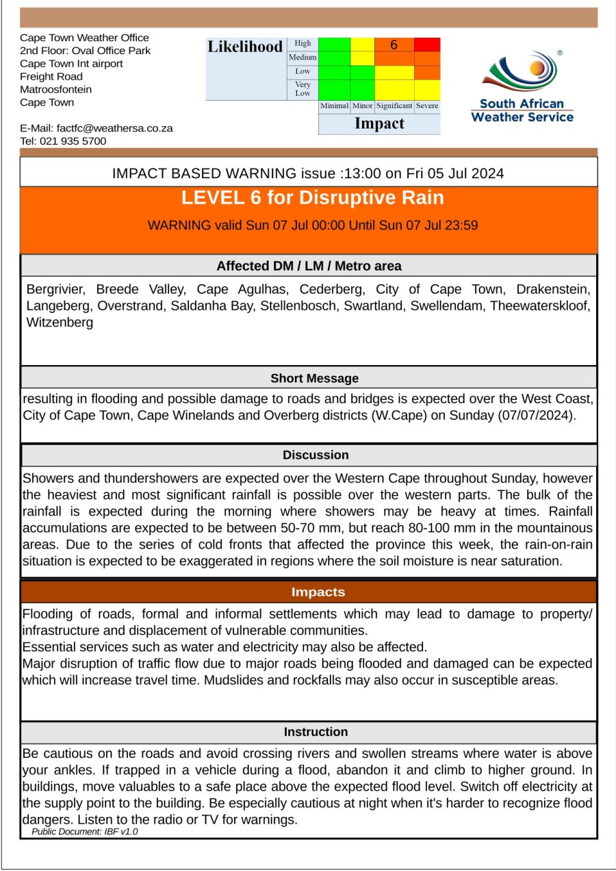
The South African Weather Service’s previously forecasted yellow level 4 warning for disruptive rain has been upgraded to an orange level 6 warning.
The bulk of the rain is expected on Sunday morning, bringing heavy and disruptive downpours that could lead to flooding. Showers, thundershowers and strong gusts of wind can be expected across the Western Cape.
SAWS’s upgraded warning is in place for the West Coast, City of Cape Town, Cape Winelands and Overberg districts on Sunday. A series of cold fronts is set to make landfall from Sunday, through to next Friday. There’s also the potential for a dusting of snow.
The inclement weather on Thursday resulted in 25 homes being damaged in Tafelsig, Mitchell’s Plain affecting more than 100 people. At the same time, 80 shacks in Sir Lowry’s Pass Village had been impacted by the overnight rainfall.
READ MORE: Cold, flooding & possible snow: Brace for a wet winter’s Sunday
The City of Cape Town’s Disaster Operations Centre confirmed that it also received reports of flooding of formal structures in Sea Point, Seawinds and Masiphumelele. Meanwhile, two houses in Kalk Bay were struck by mudslides.
The SA Weather Service has adjusted the Level 4 warning for disruptive rainfall on Sunday to Level 6.
SAWS has indicated that the bulk of the rain is likely to fall on Sunday morning, and that there is likely to be periods of very heavy downpours.#CTInfo pic.twitter.com/eiu4kabH4p
— City of Cape Town (@CityofCT) July 5, 2024
According to the city’s Charlotte Powell damage assessments are still being conducted in several other areas. Powell also shared tips for residents:
“Identify vulnerable areas on your property where mudslides could possibly occur, such as slopes or areas near water sources, and place sandbags strategically in these areas to create barriers that will divert or slow down the flow of mud,” said Powell.
USEFUL TIPS TO HELP MITIGATE THE IMPACT
- Fill bags with sand or soil, leaving room to tie or fold the top of the bag to seal it.
- Layer the sandbags in a staggered pattern to create a stronger barrier.
- Focus on reinforcing lower areas, entrances to buildings, and around structures like walls or foundations.
- Monitor the sandbags regularly and replace or adjust them as needed to maintain their effectiveness.
- Keep a supply of extra sandbags on hand in case you need to quickly reinforce or extend the barrier
“To the public in general, please avoid high-risk areas during inclement weather, like steep slopes, riverbanks, and areas prone to flooding during heavy rainfall. Help your neighbours – check on elderly or vulnerable neighbours to ensure they are also prepared for potential weather impacts, including mudslides,” added Powell.
The City’s Public Emergency Communication Centre’s number – 021 480 7700 can be used in the event of a life-threatening emergency.
